
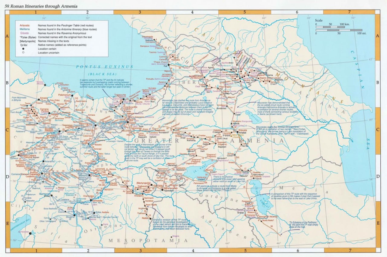
The map was compiled on the basis of the work of the Soviet academician Manandyan “On the trade and cities of Armenia in connection with the world trade of ancient times” dated 1946. The basis was taken “tabula Peuntingeriana”, compiled according to the data of the Roman cartographer Kastorius (4th century AD).
In 1965, it was translated into English by Nina Garsoyan, after which the map was compiled by the American historian Robert Husen, author of the Historical Atlas of Armenia (Armenia: A Historical Atlas). The map depicts the Roman trade routes through Armenia, including comments on Manandyan’s work, since the issue of exact routes and the location of stations is still debatable.
Evidence indicates the main trade routes, road lines, station posts and their length on the territory of Greater Armenia. The main route was the route “Artashat – Satala” (406 Roman miles = 600 km.). From the Baguana station (Bagavan) the route forked both here to Satala and to the second road “Artashat – Tigranakert”.
The road “Artashat – Sebastopolis” was also of great importance, where we are talking about Dioscuria Sebastopolis, the current Sukhumi. This road connected Colchis with the South Russian steppes. Also no less important were the paths “Artashat – Ekbatany”, also known as “Artashat – Gobdi (Khoi) – Paresaca (Parsk)” and the circular path “Artashat – Sanora (Ordubad)”. With the first way there was a connection with India and Central Asia. We must not forget about the trade routes to Trebizond, Sebastia and Melid. Thus, the country was connected by trade both with the south through Ecbatana and with the ports of the Black Sea.