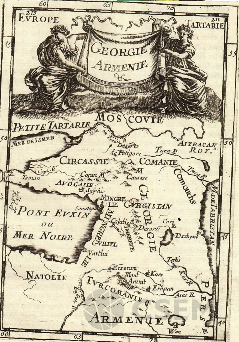
The map was compiled by the 17th-century French geographer Alain Manesson Malle and published in Malle’s encyclopedic work Description de L’Univers, published in 1683 in Paris by Denis Terry. The work consists of five books, and information about Georgia and the Caucasus is presented in the second book. Based on the works of ancient Greek, Roman and medieval European travelers (Strabo, Claudius Ptolemy, Lambert, Tavernier, etc.), the author examined the geographical position, historical past and ethnographic characteristics of Georgia and Armenia. In addition to the presented map, in connection with the Caucasus, the book also includes a map of the ancient era of the Caucasus, as well as engravings “Georgians”, “View of Yerevan” and “Armenians”.
More Stories
THE SYMBOL OF ARTSAKH – “We and Our Mountains”
The symbol of Artsakh is the monument “We and Our Mountains”. The sculpture completed by Sargis Baghdasaryanon in 1967 People...
ARMIN WAGNER GERMAN JOURNALIST DOCUMENTED ARMENIAN GENOCIDE
Armin Wagner was a German journalist and photographer who worked in the Ottoman Empire all throughout World War I. He...
ISLAMAZED AND TATTOOED ARMENIAN WOMAN FROM 1920s – Armenian Genocide
The Ottoman Empire's genocide strategy against the Armenian people began with the slaughter of males and continued with their exile...
ANCIENT ARMENIAN MEDICINE
Amirdovlat Amasiatsi's medical treatise "Useless for the Ignorant" can be seen in the photograph. Concerns over health and medicine were...
RAYMOND VAHAN DAMADIAN – ARMENIAN, The INVENTOR OF MRI
"I was thought to be crazy when I presented the idea to the audience that a person could be placed...
AZERBAIJAN DESTROYED MEMORIAL FOUNTAIN IN SHUSHI ARTSAKH in 2024
Azerbaijan was responsible for the destruction of the memorial fountain that was constructed in occupied Shushi behind the Khachatur Abovyan...
15 thoughts on “MAP OF ARMENIA AND GEORGIA-PARIS 1683”
Comments are closed.